First Name:
Last Name:
Advanced Search
Surnames
Log In
THE SERLE PAGES
Back to Page 1:
The SERLE Pages
The Other Families
THE CLEMENTS PAGES:
To Clements Page 1
THE JARVIS PAGES
To Jarvis Page 1
THE HAWK PAGES
To Hawk Page 1
Step Back
Home
Search
Login
Find
Surnames
First Names
Search People
Search Families
Search Site
Places
Dates
Calendar
Cemeteries
Bookmarks
Media
Photos
Documents
Headstones
Histories
Recordings
Videos
Albums
All Media
Info
What's New
Most Wanted
Reports
Statistics
Trees
Branches
Notes
Sources
Repositories
DNA Tests
Contact Us
Search
|
Advanced Search
|
Search Families
|
Search Site
First Name:
Last Name:
ID:
Print
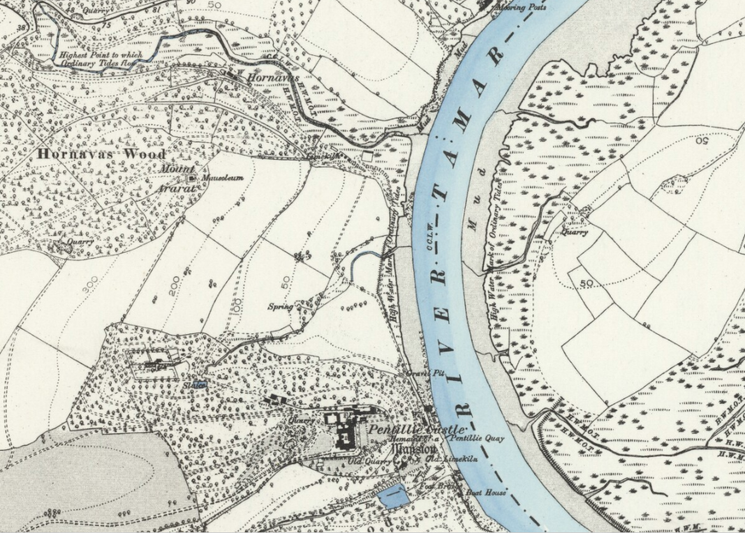
Pentillie Map
The Pentillie Estate OS map 6in to a mile
OS map circa 1852 showing Pentillie Estate (Scale 6in = 1 mile)
'Reproduced with the permission of the National Library of Scotland' http://maps.nls.uk
CLOSE WINDOW TO RETURN TO THE ARTICLE